We’re looking for roads that preferably don’t see too much traffic, and are at the same time curvy and scenic. We want to add in some light offroading that’s suitible for dual sports bikes (we’re both driving a Royal Enfield Himalayan 450).
After crossing the border in the south of Slovenia, we’re going to the big harbour town Rijeka. Its location makes it a good starting point and Sablicevo Beach just south of town is pretty. From Rijeka we’ll follow the Adriatic highway.
Adriatic Highway
The Adriatic Highway [dangerousroads.org] is a 1000 kilometers long two lane road along the Adriatic sea. It starts at Rijeka and runs all the way south through Bosnia Herzegovina to the Montenegro-Albania border. The road is quite famous as one of the few places where you can have a long and scenic drive along the see. It follows the shore, curling high along the cliffs, and doesn’t see too much traffic.
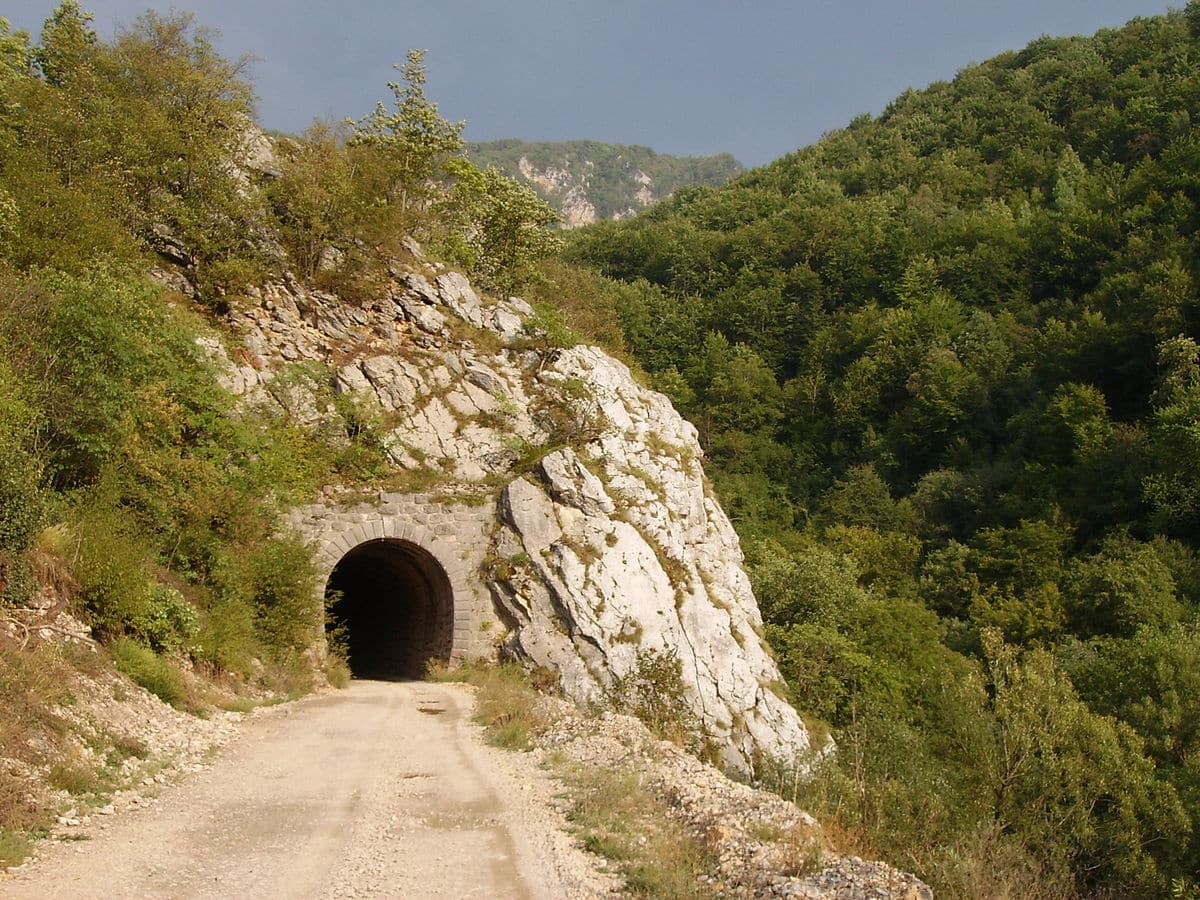
Mali Alan Pass
We’ll follow the Adriatic highway southwards for about 150 km. Just after Rovanjska, we’ll leave the main road to drive the Mali Alan Pass [dangerousroads.org]. The rock formations and views are amazing, you’ll also find some cute chapels along the road and filming locations (for Winnetoe).
The road is described as “not easy” on Dangerous Roads, but I wouldn’t say it’s too difficult for drivers with little off road experience. It looks like a well maintained gravel road without any crazy inclines (I read 11%) and I don’t see a rocky gravel on photo’s of the road online. People take their heavier dual sports bikes up here too.

How to find the Mali Alan Pass
The Alan Pass sits in between Jasenic and Sveti Rok. There’s a highway with tunnels between the two towns, so in order to find the old road you should take the D54 east of Jasenic and go north on the intersection at 44°13’04.4″N 15°40’01.7″E From there you can let Google Maps take you to Mali Alan and then on to Sveti Rok.
Skradinski Buk and Split
From Sveti Rok we’re planning to take a few small roads through the countryside to get back to the coast. On the way we found Krka National Park, with the Skradinski Buk Waterfall. It looks like a fairytale waterfall and a nice place to take a break.
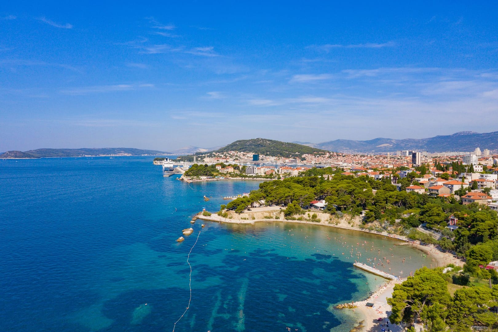
We’ll continue to the shore for another pretty stretch of Adriatic highway that looks very promising on the map. The final destination for today is Split. There’s a lot to see here.
Sights in Split
The most famous sight in Split is the Klis Fortress which towers high above the city. There’s a few roman ruins on the northern side of town, including an old theater, and the Diocletian Aqueduct in the center.
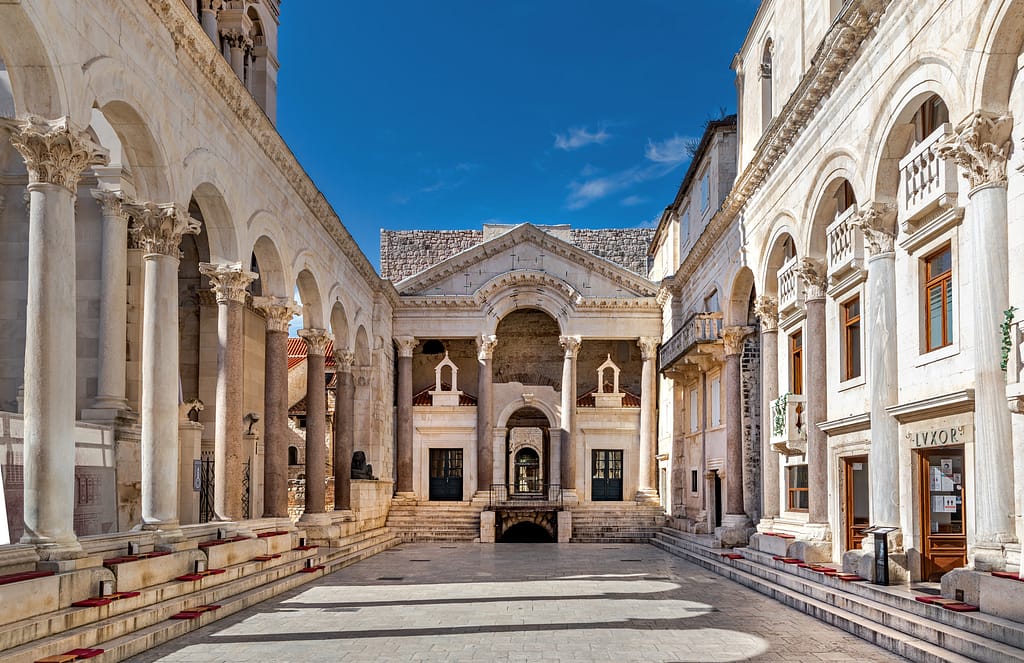
The old town has UNESCO status and there’s many sights there, for example the Diocletian Palace and the Golden Gate.
For those interested in nature, there’s a national park in town stretching into the see: Marjan. It looks good for taking a nice walk and there’s an observation deck.
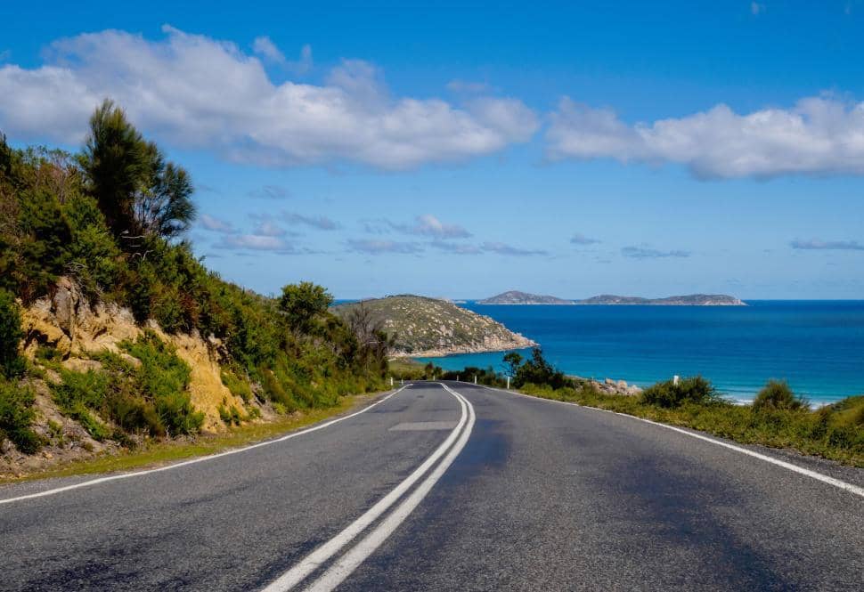
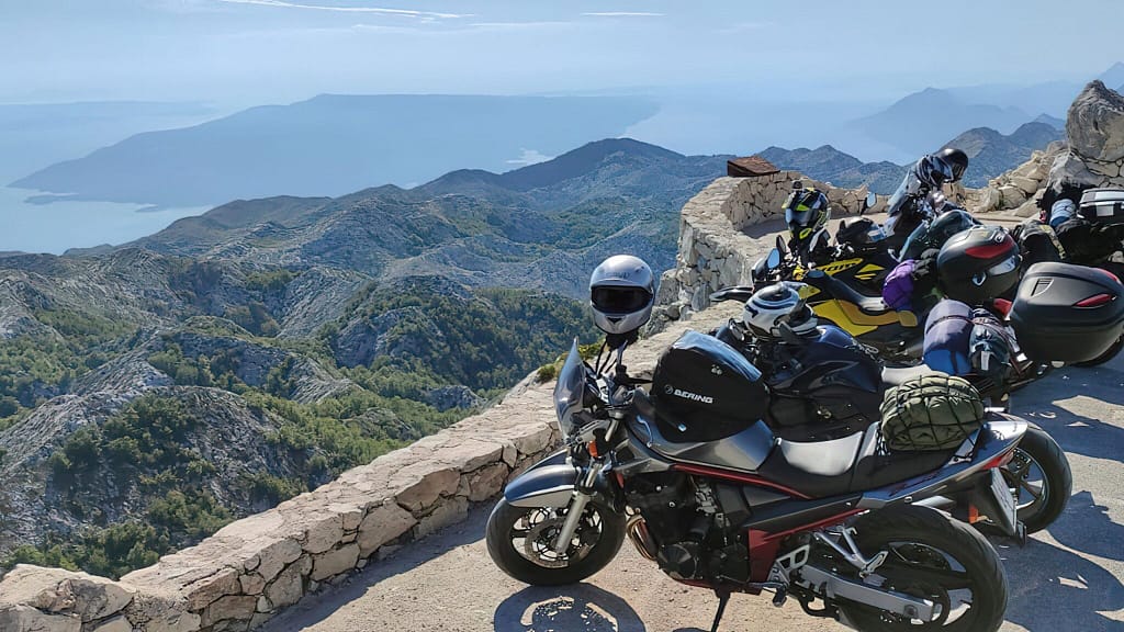
Makarska and the D512
From Split the road continues along the coast to Makarska. This looks like a good place for lunch, perhaps with a view over Nugal Beach. Makarska is the starting point of the D512 road [dangerousroads.org], one of the most beautiful coastal roads of the world.
On the map the road seems to leave the coast immediately after Makarska, which made me wonder why this is listed as a coastal road. But it goes up and follows the mountainside, making for stunning sea views. It’s passes the Biokovko national park, which has the highest motorable road in the country.
At the end of the D512 we’re spit out at the highway. We’ll continue our way on secondary roads across the border to the town of Mostar in Bosnia & Herzegovina for the next leg of our adventure.