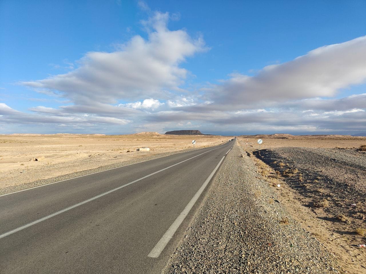
Today started with a Moroccan breakfast in our hotel together with Charlie, an English guy we met yesterday. Charlie rides a Honda CRF 450, a dirtbike-like machine that will eat almost anything you throw at it. He is joining us to the Cirque de Jaffar today. Six kilometers from Midelt our road changes to a gravel.
First of all: a summary on how to get to Circo de Jaafar
We spent a lot of time finding out about which road we’re supposed to take, especially the evening before departure but also when we found ourselves stuck in the riverbed. This is what we found out:
- Finding the road into the mountains is easy. Even Google Maps will send you in the right direction, the tarmac will change to piste around 32.640470, -4.767004
- Follow the piste until you get to the wadi. The road on Google Maps is not passable anymore as of December 2024 from this location 32.540429, -4.896474
- We eventually turned around there, but from what I heard from other travellers later on, the actual Jaafar Canyon can be found if you continue along the wadi and take the right arm when it splits. This is good indication of the road on wikiloc.
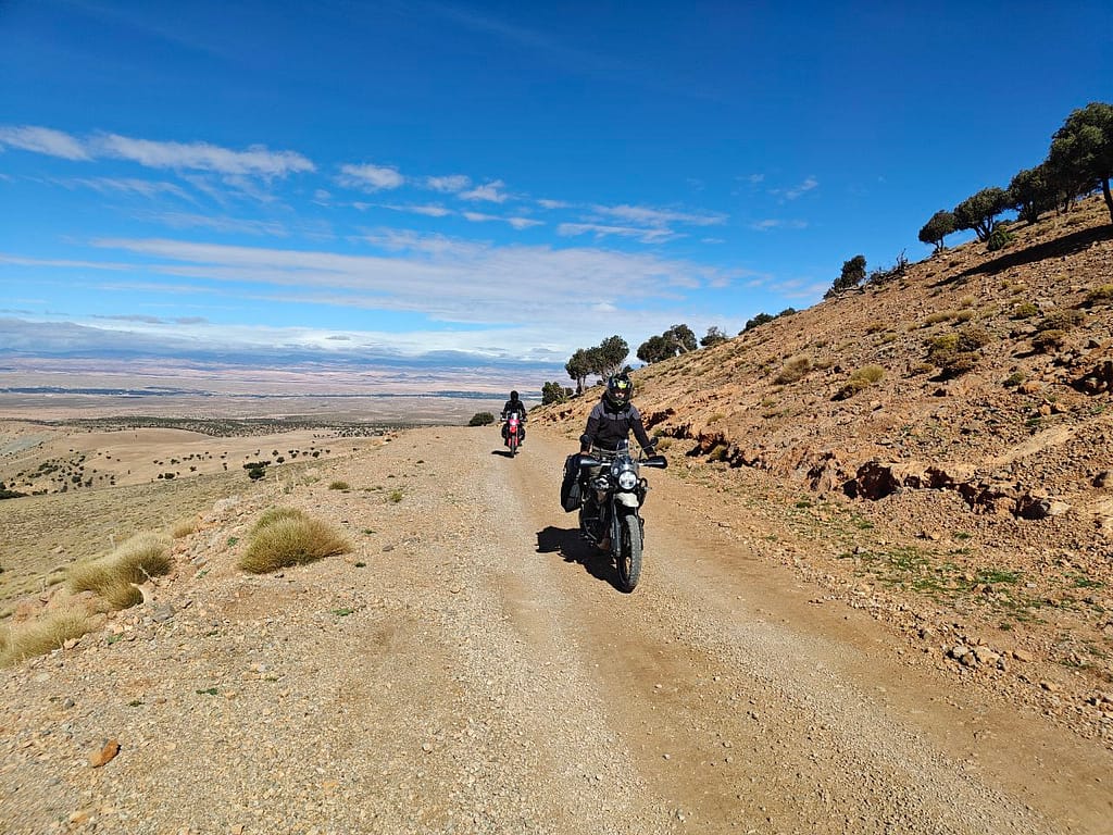
- If you’re new to offroading or your bike is too heavy, only driving into the mountains over the piste and back to Midelt is also a good option. It will take around 3 hours to get there, take some photos and get back.
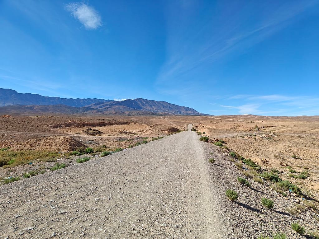
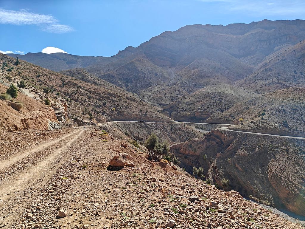
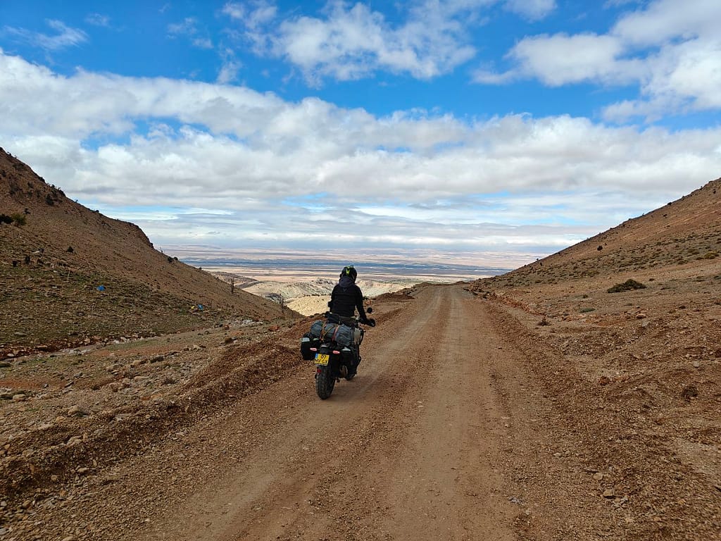
The views are fantastic in different shades of yellow and orange under a blue sky, but above all a lot of space. The condition of the piste is actually really good and the views are already amazing before we even get to the mountains.
Where did the road go?
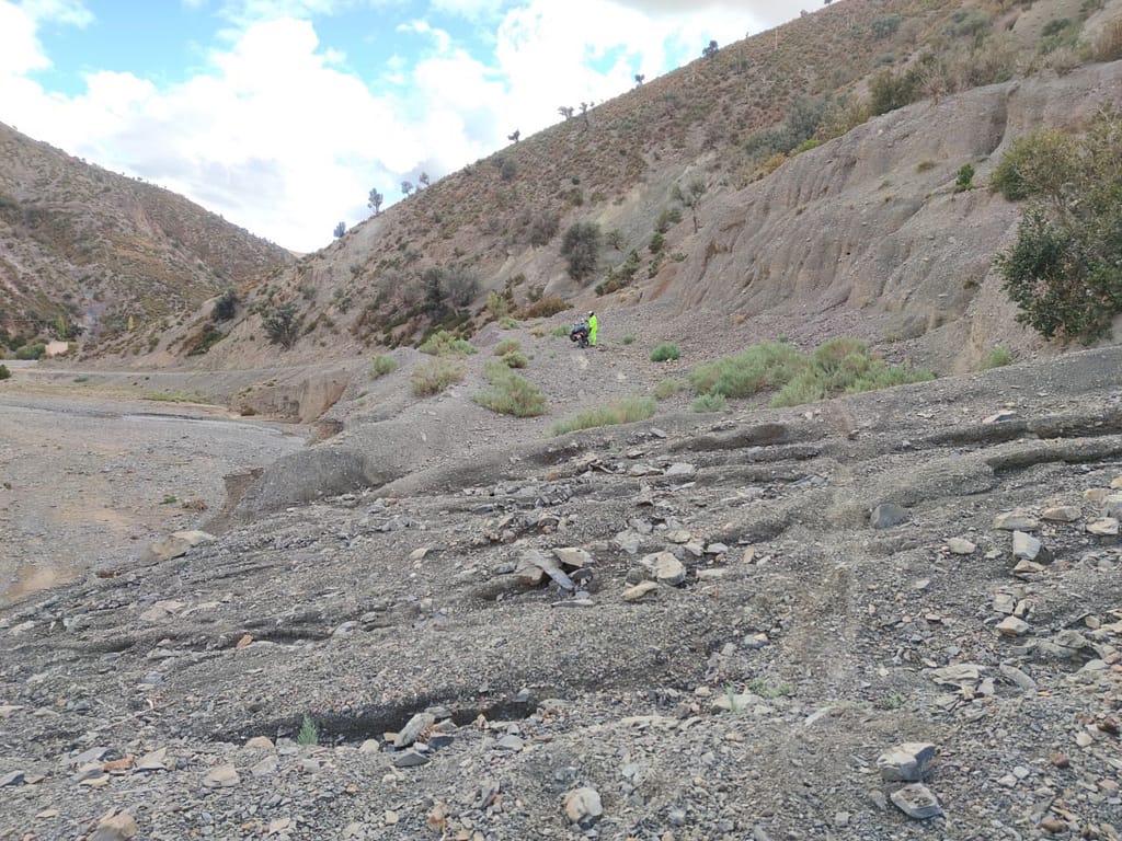
When we are close to the Cirque de Jaffar according to Google maps, a goat herder jumps onto the road to show us the way. When he has guided us through a few hundred meters and three turns while running ahead, his hand goes up, we have to pay. I don’t really know why, because we didn’t ask for any help and we were just following the map. Very dissatisfied with the 20 dirhams I offer he finally accepts. But we don’t really get any further, in the meantime two more people have joined us and in language that is difficult to follow they explain that we can’t continue our way. Unless we drive up a way too steep slope of loose sand.
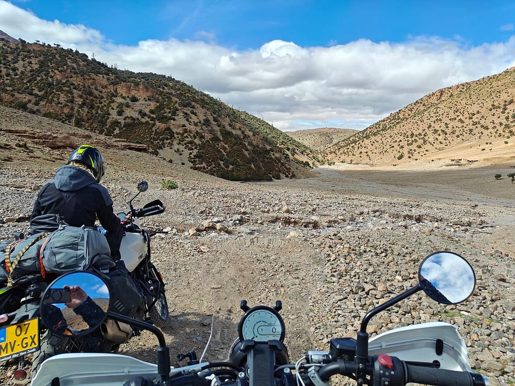
Charlie takes his bike over the worn out riverbed and tries to find a way by himself, but ends up coming back. The road to Imilchil has been washed away by recent downpours. Much later we find out that you can follow the riverbed all the way through the gorge and pup out at the other side. But at this time there’s three people around us trying to get us in all directions and we can’t be sure if any of the information they’re giving is really going to help us. Anyway, we don’t want to spend the night on the riverbed, so eventually we call it a day.
Plan B, back to Midelt
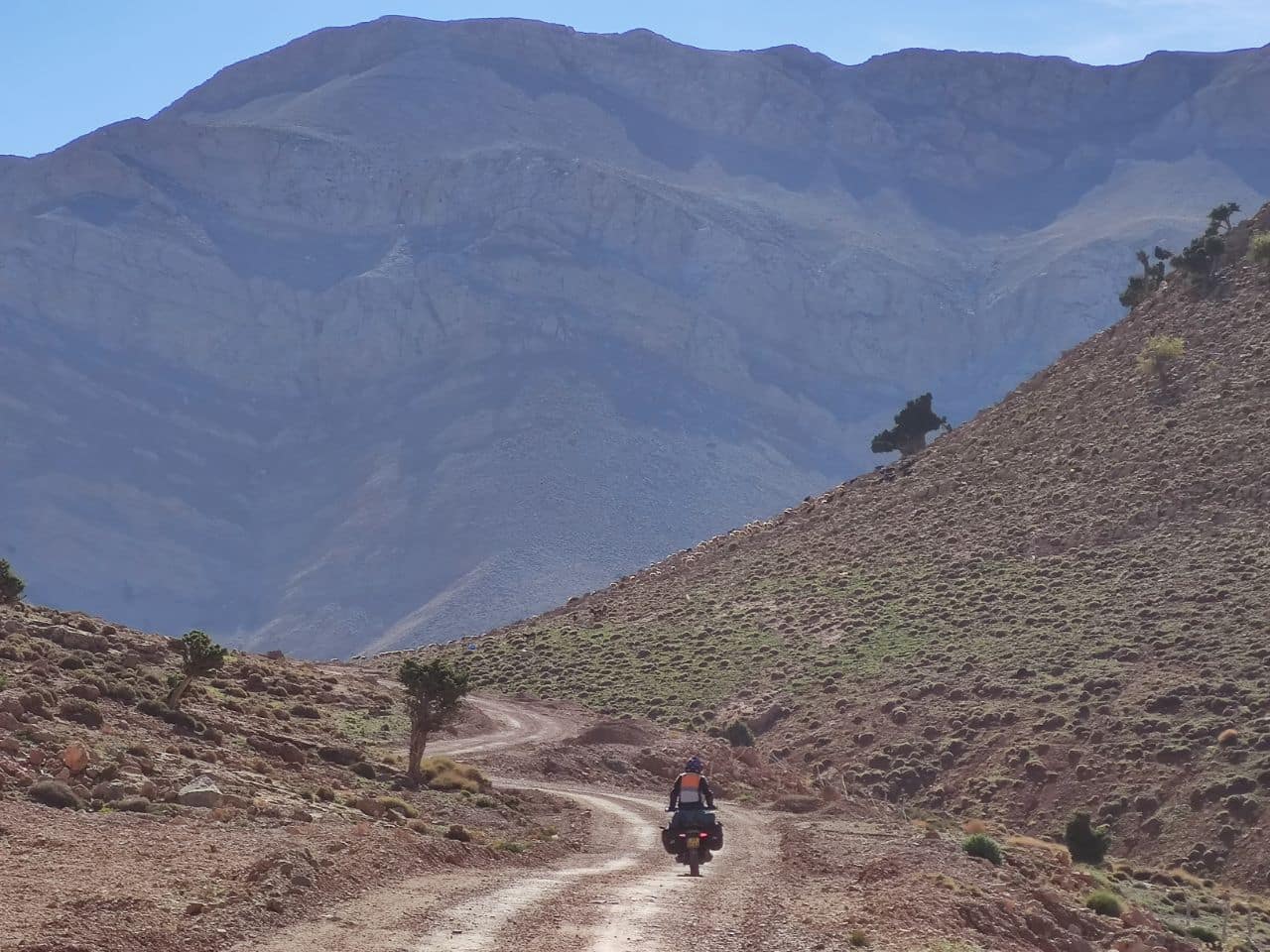
We decide to take the same road back to Midelt and try to get around the Circo de Jaafar to find our way to Imilchil from there. The road up to here was already adventure and we have ploughed over more stones than we thought we could with these motorcycles. The fresh off-road experience we gained is clearly noticeable when we drive back. We’re much more relaxed standing on the footpegs leaving a cloud of dust.
After a shawarma in Midelt we say goodbye to Charlie who is going to Merzouga, as we set course for Tagoudit, a small town near Imilchil. Dark clouds are gathering above the vast empty landscape and it is already drizzling a bit, Tweety time. The rain suit also provides some extra warmth in the increasing cold. This morning we were still wondering whether we were actually entering the High Atlas today. The map gave us a definitive answer, but once outside we could have seen it: it clearly towers above the mountains we’ve been driving in up until now.
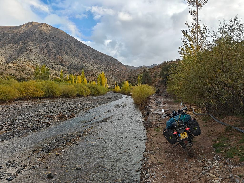
The surroundings are overwhelming again and we often stop to capture it, although we do smell something fishy. Google is calculating crazy amounts of time for the last few kilometers. When we reach the last ten kilometres it becomes clear why: the road along the river is almost completely gone here and there, we almost have to squeeze our way along the river with some really narrow stretches. What we didn’t know is that locals have stopped using this road a long time ago. But it remains popular among off road anthusiasts. Maybe that’s why the men we passed near the last house on this route didn’t tell us to take another way.
Plough on or sleep next to the river
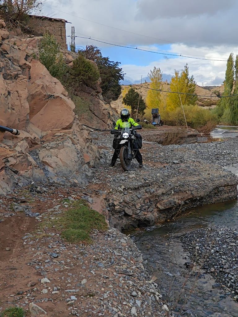
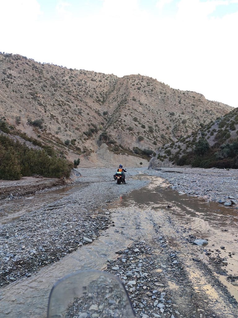
But we are put to the test even more. Not only has the river washed away parts of the road, the road is also blocked by avalanches of sharp stones. With a lot of revs and clutch we get both motorbikes over large piles of them. We cross the riverbed which is an obstacle course of larger stones. Finally, as we feared, the road is no longer passable, huge avalanches of stones have completely washed it away. So far we have only covered three kilometres, it took us almost 2 hours.
On the other side of the riverbed, there is only a little water flowing at the moment, there’s a wall saying “Guesthouse 7 km’s”. We have to enter the riverbed, a thick layer of loose gravel with gullies and hills. Riding while standing is getting better and better and Walter skillfully makes his way forward, through the water, over piles of stones. But the progress is slow, it’s already after six o’clock as we come within five kilometres distance and there is still no improvement to be seen. The riverbed remains the only option.
In Tagoudit at last
Gerbrich is out of energy, she drops the bike once more, fortunately without any damage. She needs a moment to recover and then continues. It doesn’t feel safe to me to have to sleep in a tent next to this river with all the rain and very low temperatures predicted. Eventually after a long stretch of riverbed, a man on a horse appears and reassures us that we can follow the river until the village. Tire tracks appear at last and then the village comes into view. Once inside the guesthouse our host tells us to settle in front of the stove, but actually we are both still hot from the intense driving. But we’re very happy that we can hang our gear to dry in the cosy living room.
Our host tells us that we took the old road, there is little left of it. The road from Tagoudit to Imilchil is mostly tarmac, although it has some challenging river crossings. The accommodation is a frequently visited accommodation for off-roaders, and in 2014 the Dakar Rally passed here. The walls and doors are full of stickers and photos of people who have earned their stripes here.
Our recommendations along this route
Jebel Raids Guesthouse
We had a good stay here. Very comfortable and clean guesthouse with a fireplace and hot water. The village is small but they will cook three meals a day for you, the food is excellent.